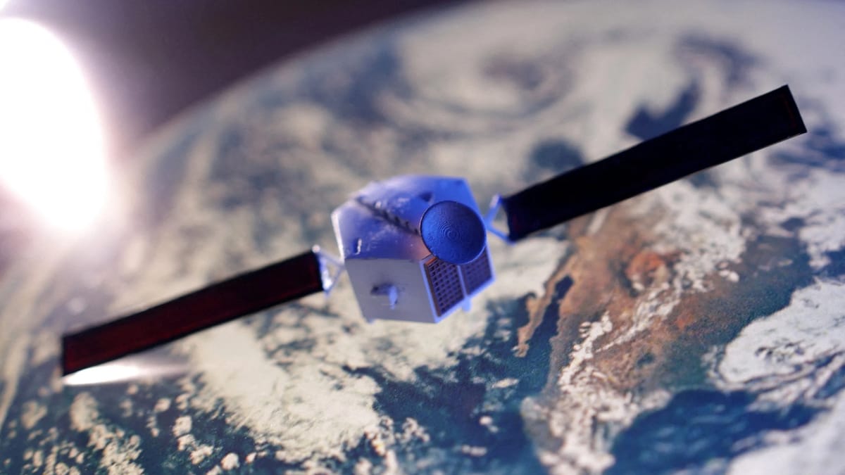
Pixxel-led Consortium Revolutionizes India's Space Sector: A Deep Dive into the Commercial Earth Observation Constellation
India's private space sector is taking a giant leap forward with a historic public-private partnership led by PixxelSpace.

Written by Lavanya, Intern, Allegedly The News
BENGALURU, INDIA, August 13, 2025
The Final Frontier: Pixxel and the Rise of India’s Private Space Sector
For decades, the Indian space narrative was synonymous with a single name: ISRO. A beacon of national pride, ISRO’s remarkable journey from a humble church outhouse to a global leader in cost-effective missions like Chandrayaan and Mangalyaan has been the stuff of legend. But a seismic shift is underway. A new generation of ambitious, agile, and privately funded startups is now taking the helm, fundamentally redefining India's space strategy. At the forefront of this revolution is a consortium led by PixxelSpace, a Bengaluru-based company poised to launch a game-changing Earth observation satellite constellation. This is not just another mission; it is the genesis of India's new commercial space economy, a powerful testament to the nation’s technological prowess and entrepreneurial spirit.
The Mission Unveiled: India's Indigenous Eye in the Sky
In a landmark announcement, the Indian National Space Promotion and Authorisation Centre (IN-SPACe) selected a consortium led by PixxelSpace to design, build, and operate India's first fully indigenous commercial Earth observation (EO) satellite constellation. This groundbreaking public-private partnership (EO-PPP) is a first in India’s space history, with the private sector taking on the mantle of a mission of national importance. The consortium, which also includes PierSight Space, Satsure Analytics, and Dhruva Space, will invest over ₹1,200 crore over five years to deploy a 12-satellite constellation.
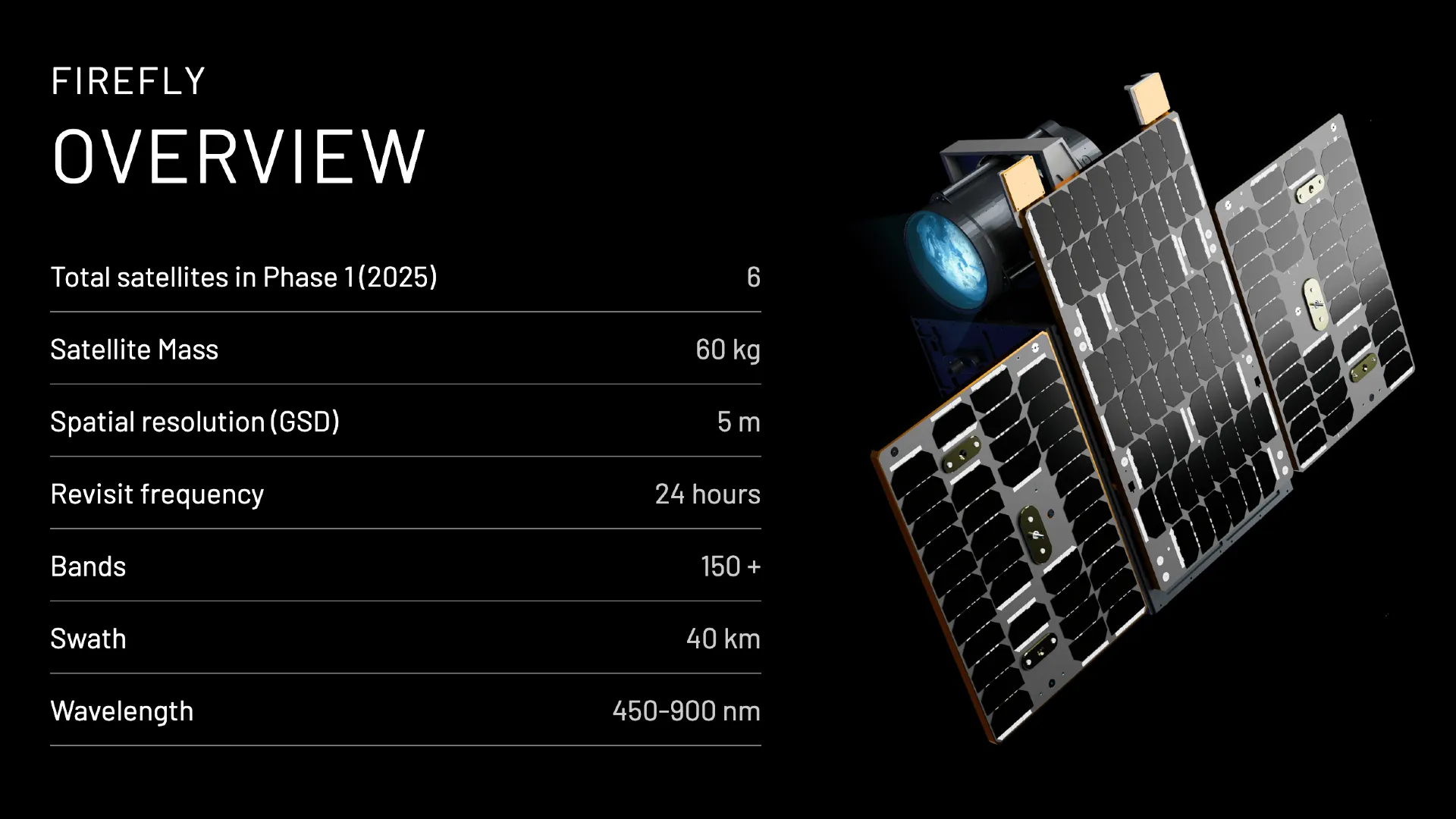
This project is far more than a simple satellite launch; it is a strategic maneuver to achieve data sovereignty. For too long, India and other nations have relied on foreign satellite data, creating vulnerabilities in a world where geospatial intelligence is as critical as any military asset. By building an independent and robust system, India is ensuring its critical sectors - from agriculture and disaster management to national security - have unfettered access to timely and high-quality information. The constellation, once fully operational, will provide daily global coverage with a remarkable 5-meter spatial resolution, offering analysis-ready data to a wide spectrum of government and private clients.
A Structured Timeline of the Mission
- 2025-2030: The five-year project commences with the initial funding and the start of design and manufacturing of the 12-satellite constellation. The consortium's ₹1,200 crore investment will be deployed in a phased manner.
- Phased Deployment (2026-2029): The satellites will be launched in several phases over the next four years. Pixxel has already launched its "Firefly" satellites as technology demonstrators, and this new constellation will build on that foundational success.
- Initial Operational Capability (IOC): Within the next 2-3 years, a subset of the constellation will achieve IOC, beginning to deliver data and value-added services to early adopters.
- Full Operational Capability (FOC) (2030): The entire 12-satellite network is expected to be fully operational, providing daily, comprehensive coverage of the Earth.
- Continuous Innovation: The mission is not static. The consortium's model allows for continuous upgrades and the integration of new technologies, ensuring the constellation remains at the cutting edge of Earth observation for years to come.

The Technological Edge: A Leap into Hyperspectral and SAR Intelligence
The consortium's technological prowess is a key differentiator. The constellation will not rely on a single type of sensor but will integrate a multi-payload system to provide a richer, more comprehensive view of the Earth.
Payloads and Sensors
- Hyperspectral Imaging (Pixxel): Pixxel’s satellites are the crown jewels of this mission. While traditional satellites capture data in just a few spectral bands (like a basic color photograph), Pixxel’s hyperspectral sensors capture hundreds of narrow bands. This allows for a detailed “spectral fingerprint” of the Earth's surface. This data can be used to precisely identify specific minerals, track changes in vegetation health, detect subtle environmental pollutants, and even differentiate between different types of soil. It's like moving from a limited color palette to a full, high-definition spectrum.
- Synthetic Aperture Radar (SAR) (PierSight Space): PierSight's SAR payloads are a game-changer. Unlike optical satellites that are limited by cloud cover or darkness, SAR technology uses radar to create high-resolution images regardless of weather conditions or time of day. This is indispensable for round-the-clock marine surveillance, post-disaster damage assessment (when clouds often obscure the ground), and monitoring for illegal activities like mining or fishing.
- Optical & Multispectral Payloads (Satsure Analytics): Satsure will provide traditional high-resolution optical imagery, which is crucial for applications like urban mapping and land-use analysis. The combination of these payloads ensures that the constellation can serve a broad range of client needs.
- Satellite Bus & Subsystems (Dhruva Space): Dhruva Space, a leader in satellite platforms and orbital solutions, will provide the crucial hardware and integration services. Their expertise ensures the satellites are built on robust, reliable platforms, minimizing mission risk and accelerating deployment.
This multi-payload approach, combining the unique strengths of hyperspectral, SAR, and optical imaging, positions the consortium to deliver an unmatched level of data and insights, giving India a powerful competitive advantage in the global market.
A New Paradigm: Government-Led vs. Private-Led Satellite Projects
For decades, ISRO was the sole architect of India’s space missions. Its focus was on foundational research, strategic asset creation for national security, and technology development for communication and weather forecasting. These missions, while brilliant and crucial for national development, often had long timelines and were not primarily driven by commercial urgency.
The new private-led model, enabled by the Indian Space Policy 2023, introduces a new dynamic:
| Feature | Government-Led (ISRO) | Private-Led (Pixxel) |
| Primary Goal | Strategic, Scientific, and Developmental | Commercial, Market-Driven, and Scalable |
| Pace of Development | Long-term, often with multi-year R&D cycles | Agile, rapid iteration, and commercial deployment |
| Funding | Government Budgetary Allocation | Private Capital (VCs, PE, Corporate Partners) & PPP |
| Risk Appetite | Generally conservative, focused on mission success | Higher, encouraging rapid innovation and new technology |
| Market Focus | National requirements, scientific advancement | Global commercial market, diverse customer base |
The EO-PPP model brilliantly marries the strengths of both. It leverages IN-SPACe’s regulatory oversight, technical expertise, and access to ISRO’s infrastructure while harnessing the private sector's speed, innovation, and capital. This partnership creates a synergy where public and private capabilities reinforce each other, driving growth and ensuring self-reliance (Atmanirbhar Bharat).
Indigenous Innovation: Building a Self-Reliant Space Ecosystem
One of the mission's most significant goals is to minimize India's reliance on imported components and technology. By designing and manufacturing the entire constellation on Indian soil, the project will catalyze the growth of a domestic space supply chain. This focus on indigenization is a cornerstone of India's long-term strategic vision. It not only reduces costs and geopolitical risks but also creates a high-tech ecosystem that generates thousands of skilled jobs.
The consortium's commitment to using indigenous components is a direct outcome of the government’s push for a more open and self-reliant space sector. It is a powerful signal to the global community that India is not just a consumer of space technology but a producer and a leader. This is the new face of Indian innovation—one that is driven by startups, supported by policy, and aimed at both national and global markets.
The Data Revolution: Aiding Governance, Business, and Sustainability
The high-resolution data from this constellation will be a catalyst for a data-driven revolution across India’s economy and society.
Impact on Governance and Public Sector
- Disaster Management: The continuous, all-weather coverage of SAR and the detailed analysis of hyperspectral data can provide real-time information for flood mapping, landslide detection, and damage assessment after natural disasters. This allows for faster and more effective rescue and relief operations.
- Urban Planning: City planners can use the data to monitor urban sprawl, identify illegal encroachments, and optimize infrastructure development. This leads to more sustainable and efficient cities.
- Agricultural Intelligence: Government agencies can monitor crop health, predict yields, and manage irrigation systems, which are crucial for ensuring food security and supporting the agricultural sector, which employs a significant portion of the population.
- National Security: The constellation provides a sovereign source of intelligence for border surveillance and monitoring of strategic assets, reducing dependence on foreign sources and enhancing national security.

Applications for Private Businesses
- Agriculture: Farmers and agricultural companies can use the hyperspectral data to detect crop diseases and pest infestations long before they are visible to the naked eye. This enables precision agriculture, where fertilizers and pesticides are applied only where needed, reducing costs and environmental impact.
- Environmental Monitoring: The data can be used to track deforestation, monitor water quality, detect oil spills, and quantify carbon sequestration. This is invaluable for companies focused on sustainability, environmental compliance, and those involved in carbon credit markets.
- Energy & Mining: The satellites can assist in identifying potential mineral deposits, monitoring pipelines for leaks, and ensuring environmental compliance at mining sites.
- Financial Services: Insurance firms can use the data to verify crop damage claims or assess property damage from natural calamities. Commodity traders can use crop yield data to make more informed market decisions.
India's Global Position: A New Leader in the Space Race
The global commercial Earth observation market is a multi-billion-dollar industry. While traditionally dominated by a few established players, India is rapidly carving out a significant niche. The country’s history of cost-effective missions, coupled with the agility of its new-age startups, positions it as a formidable competitor. The Pixxel-led consortium's focus on innovative, high-frequency, and multi-sensor data provides a unique selling proposition that can challenge the existing market leaders.
By 2033, India aims to capture 8% of the global space market and grow its space economy from $8.4 billion to $44 billion. The Pixxel-led mission is a cornerstone of this vision, demonstrating to the world that India has the capability, the talent, and the policy framework to be a global leader in space-based data solutions.
A New Era of Space Entrepreneurship
The selection of the Pixxel-led consortium is more than a commercial contract; it is a profound declaration of intent. It signals the irreversible shift in India's space policy, from a state-run monopoly to a vibrant ecosystem of public and private collaboration. The success of this mission will be a powerful testament to the potential of Indian innovation and entrepreneurship. It will not only provide India with a sovereign source of critical geospatial data but also inspire a new generation of engineers, scientists, and entrepreneurs to look to the stars with commercial intent. The final frontier is no longer a government-exclusive domain; it is now open for business, and India's private sector is leading the charge.
What This Means for Tomorrow
This project is a critical case study in how government policy can successfully foster private sector growth in strategic industries. It showcases a model for how a nation can leverage its established public infrastructure and expertise to accelerate commercial innovation. As the world watches, India is setting a new precedent for space development, one built on collaboration, indigenous technology, and a vision of a truly self-reliant space economy.
Policy and Regulation
How can IN-SPACe further accelerate the growth of this nascent sector by streamlining regulations, providing easier access to launch facilities, and creating a dedicated fund to support space startups?
Sources
IN-SPACe official announcements and press releases; statements from Pixxel and other consortium members; Pixxel official promotional materials, Press image from Pixxel or similar space technology media kit, NASA Earth Observatory, Pixxel satellite imagery, economic and policy reports from research firms; and news reports from The Economic Times, The Hindu, and other verified publications.


